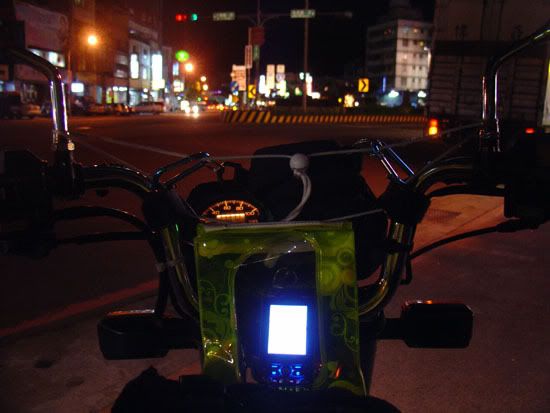
So with my trusty hand-me-down Sony Ericsson k810i (released: 2007) and my even trustier TomTom Mark II bluetooth GPS receiver (released: 2005), some free online tools and Google Maps, I turned my non-smartphone phone into a navigation unit complete with waypoints and markers:
- I went to www.TrekBuddy.net and downloaded their wicked awesome gps tracking app.
- I used Mobile Atlas Creator to create the entire Google Maps of Taiwan (including a bunch of zoom levels) into a handy zip file and copied to TrekBuddy's atlas folder.
- I used Google Maps to plan my original route.
- Since Google Maps doesn't actually have an option to export directions, I used GMapToGPX to create a directions file for TrekBuddy.
- Hooked up the TomTom to the phone, strapped the phone to the front of my bike. Ready to roll, simple as.
Despite my reputation for being a bit of a techy person, I very rarely have the latest and greatest hardware. Most true tech people don't. We just know how to use what we have to beyond their intended abilities.
I like to think of it as the less-greasy version of bodging something together. =)
There are those who'd think it's a lot of bother for a bit of extraneous convenience... but that'd be missing the point completely.
No comments:
Post a Comment